Thursday, March 31, 2005
Mitten Ridge
The Mitten Ridge gallery is now online, launching a new format for the Earth Gallery. Instead of linking each photo gallery, the trail names will link to trail information pages with the galleries linked on those pages.
Wednesday, March 30, 2005

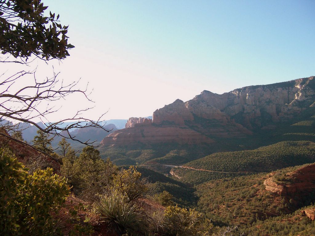
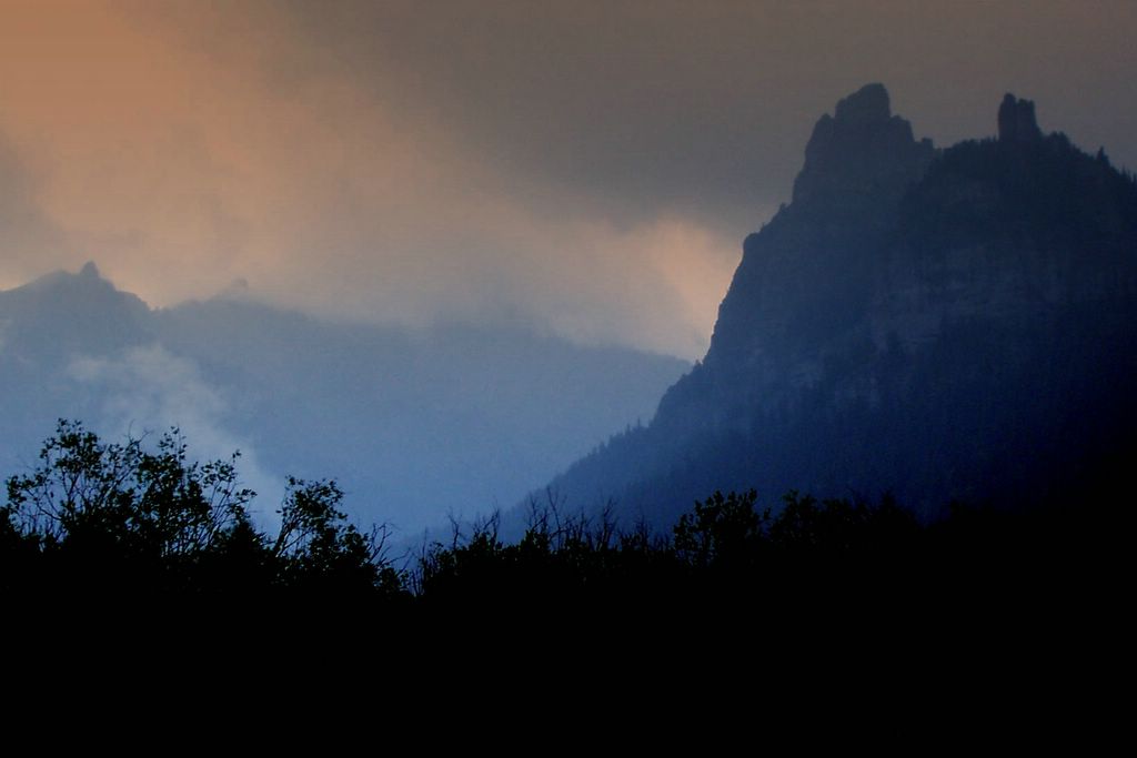
View of San Francisco Peaks from Wilson Mountain (hiked 27 March)
Oak Creek Canyon, Arizona
photo © 2005 deborah
www.deborah.ws
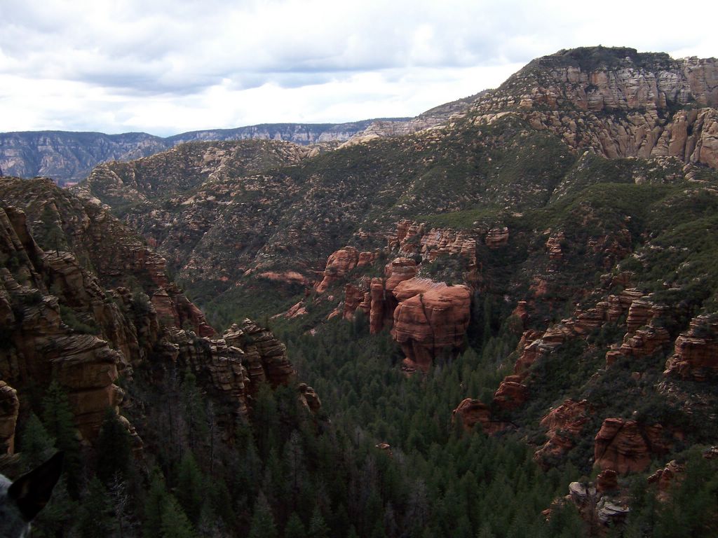
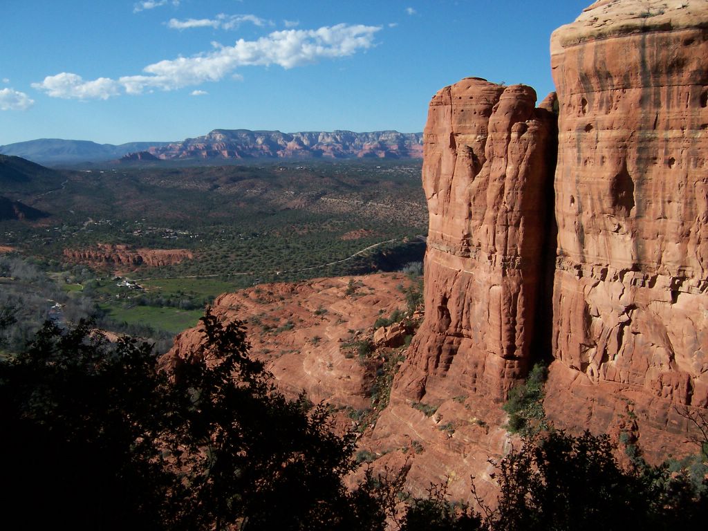
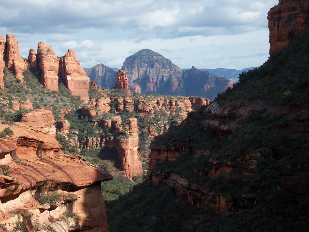
View of Steamboat Rock, Midgely Bridge, and Wilson Mountain from Mitten Ridge
Sedona, Arizona
photo © 2005 deborah
www.deborah.ws

Sunday, March 27, 2005

Wednesday, March 23, 2005

Tuesday, March 22, 2005

Monday, March 21, 2005

Stained Glass Tapestry
Created with Mehdi's Kaleidoscope Photoshop Plugin
Kaleidoscope gallery coming soon to my site
photo © 2005 deborah
www.deborah.ws
Sunday, March 20, 2005


Saturday, March 19, 2005
Tuesday, March 15, 2005

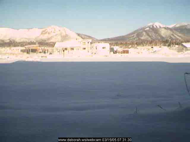
The sprinkles and lightening we experienced on Sunday's hike in Sedona were to become around 8 inches of snow here at home
photo © 2005 deborah
www.deborah.ws

Daylily Bonanza
Original photography, Kai's Power Tools enhancements
photo © 2005 deborah
www.deborah.ws
Monday, March 14, 2005
North Wilson Mountain Trail - March 13, 2005
The day promised to be beautiful, and the weatherman mentioned rain that night... by the time we got on the road and to the trailhead, it looked like the rain would be early. It did drizzle a little, and was overcast for much of our hike, but when we got to First Bench, it was clear that we were at the edge of a storm to the north of us. Sedona was bathed in sunlight, and the rain even cleared enough to let us see the San Francisco Peaks.
The trail sign says the trail is easy, with an elevation change of a mere 1700 feet over two miles. Actually, the trail's not easy -- 1350 feet of that elevation change is in a half a mile (not that gaining 850 feet per mile is a relaxing stroll), with tall "steps" up rocks, and slippery footing in places (when it's dry, the gravel on the trail can be a bit tricky to come down). Thankfully, the Wilson Mountain Trail web page is a bit more realistic.
To repay you for the workout, you will be rewarded with a very pretty trail and fantastic views. The trail winds up a forested canyon, getting steeper as it goes. The views north up Oak Creek Canyon are excellent from this section of the trail. The trail pops out on First Bench of Wilson Mountain (1400 feet above the trailhead), where a mild grade takes you to the junction of North Wilson Mountain Trail and Wilson Mountain Trail. The latter trail coninues to the top of Wilson Mountain (2200 feet above the trailhead, at 7000 feet), which we have planned for the next blue-sky weekend. Keep heading south to get the reward -- breathtaking views over Sedona. On a clear day, the San Francisco Peaks are visible to the north. From First Bench, you can see straight into Munds Canyon, east across Oak Creek Canyon.
A photo is posted below. Visit my Earth Gallery to see all the photos from this hike.
Sunday, March 13, 2005

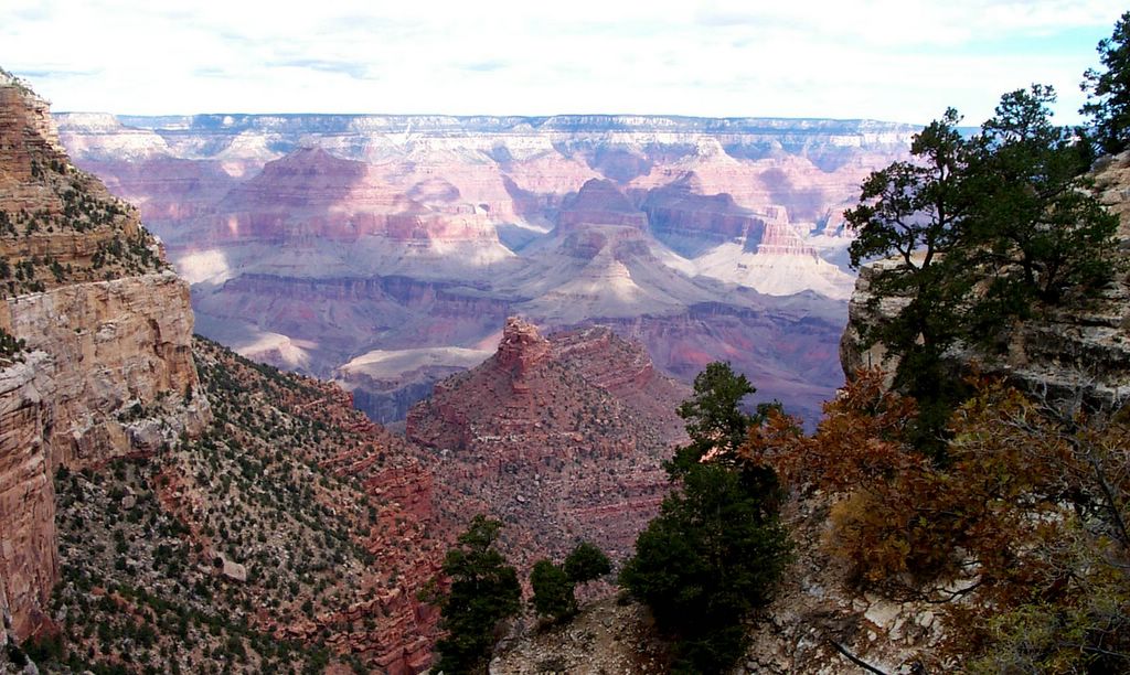
Red Rocks, Big Sky
View from First Bench, Wilson Mountain Trail, into Sedona
photo © 2005 deborah
www.deborah.ws
Saturday, March 12, 2005

Thursday, March 10, 2005
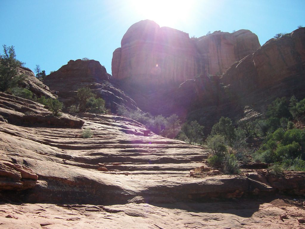
Cathedral Rock Trail
This is an excellent trail off of Back O' Beyond Road, about three miles past the 'Y' on 179 going out of Sedona. The trail up to the junction with Templeton Trail is pretty easy, and the views are great. From there, the trail's a bit more challenging, requiring a bit of scrambling up slickrock in a few spots. The trail leads up to a saddle in Cathedral Rock, where the views in both directions are spectacular. There's lots of nooks and crannies to explore, and we found a fantastic spot to eat lunch and enjoy the views. The trail is about 3/4's of a mile long and can be moderately strenuous in places.
Two photos from this hike have been posted below. Visit my Earth Gallery to see all the photos from this hike.

Tuesday, March 08, 2005
Sunday, March 06, 2005
Fay Canyon Trail
The day started off overcast and rainy. Because of road closures around the forest, we parked at the Boyton Canyon Trail parking area and walked to Fay Canyon Trailhead. By the time we hit the trail, the rain stopped. Eventually, the weather cleared and the sun came out, giving us a beautiful hiking day.
Instead of hiking up to Fay Canyon Arch (see our hike last month), we went to the end of the trail and explored what the Magnum's book describes as a ship prow shaped "fin." Ascending to the base of the fin gave us fantastic views down the canyon towards Sedona. Thinking there was a route to the top of the fin, where the views could only get better, we skirted the base of the formation until we reached a gully. We explored for a route to the top, and opted to go up another formation across the gully. After a lot of bush whacking, we were rewarded with a lovely place to have lunch and enjoy the remarkable view down the canyon.
Two photos from this hike have been posted below. Visit my Earth Gallery to see all the photos from this hike.

Saturday, March 05, 2005
Arizona Cypress Trail Redux
We returned to the Cockscomb Trails area to try Arizona Cypress Trail again. When we'd hiked the Cockscomb Trails at the end of January, the creek was very high, and instead of wading across at the last crossing, we decided to try to take Arizona Cypress up to the road. Well, we had to bushwhack quite aways before we found the trail, which according to the map follows the creek. This week, we followed AZ Cypress down from its trailhead, and we discovered the reason we couldn't find the trail is because at some points, it is in the creek. When the creek is actually running high, there's no way to stay on the trail. We found the crossing over to OK Trail - good thing we didn't try it, the water would have been over our heads.
It was a short hike this time, even though there are miles of trails in the Cockscomb Trail system. We had a nice picnic near the creek, looked for pretty rocks along the banks, and enjoyed the beautiful weather. Photos from this hike will be posted in my Earth Gallery in a week or two. Two photos have been posted below.
It was a short hike this time, even though there are miles of trails in the Cockscomb Trail system. We had a nice picnic near the creek, looked for pretty rocks along the banks, and enjoyed the beautiful weather. Photos from this hike will be posted in my Earth Gallery in a week or two. Two photos have been posted below.


Friday, March 04, 2005


Tuesday, March 01, 2005


Subscribe to:
Posts (Atom)