Tuesday, October 11, 2005

Arches in Grand Staircase-Escalante


Arches in Grand Staircase-Escalante
Sunset Natural Arch is in the distance on the left side of the image. A smaller arch located to the south is in the central foreground. See the full resolution panorama and additional photos on my website.
October 2005

photo © 2005 deborah
www.deborah.ws

Monday, October 10, 2005


Sunset Natural Arch
Grand Staircase-Escalante, Utah
October 2005
photo © 2005 deborah
www.deborah.ws

Sunday, September 18, 2005


Wheel assembly from 1944 B-24 wreckage on the San Francisco Peaks, Flagstaff, Arizona
photo © 2005 deborah
www.deborah.ws

Thursday, September 15, 2005


View of San Francisco Peaks from Old Caves Crater
Flagstaff, Arizona
photo © 2005 deborah
www.deborah.ws

Wednesday, September 14, 2005


Sunset Crater seen from Bonito Park
Flagstaff, Arizona
photo © 2005 deborah
www.deborah.ws

San Francisco Peaks seen from Bonito Park
Flagstaff, Arizona
photo © 2005 deborah
www.deborah.ws

San Francisco Peaks seen from Robinson Mountain
Flagstaff, Arizona
photo © 2005 deborah
www.deborah.ws

Friday, September 09, 2005


Humphreys Peak
Weatherford Trail, July 2005
photo © 2005 deborah
www.deborah.ws

Wednesday, September 07, 2005

San Juan River Gallery Now Online!

The image gallery for our San Juan River trip in May 2005 is now online! In addition to the gallery, I've added a San Juan River Atlas which includes a wide variety of overview and detail maps for the river.

Also new on the site:

Abineau Avalanche Damage, Revisited


Avalanche Damage along Abineau Trail
View from above the damage at the upper part of the canyon
San Francisco Peaks, Flagstaff, Arizona
photo © 2005 deborah
www.deborah.ws

Sunday, September 04, 2005

Abineau Avalance Damage


Avalanche Damage along Abineau Trail
View from below the damage on the lower portion of Abineau Trail
San Francisco Peaks, Flagstaff, Arizona
photo © 2005 deborah
www.deborah.ws

Skunk Canyon


Flower filled meadow
Skunk Canyon, Flagstaff
photo © 2005 deborah
www.deborah.ws

Thursday, August 25, 2005

Sandys Canyon


Mt. Elden
Along Sandys Canyon Trail, Flagstaff, AZ
24 August 2005
photo © 2005 deborah
www.deborah.ws

Flowery Meadow
Along Sandys Canyon Trail, Flagstaff, AZ
24 August 2005
photo © 2005 deborah
www.deborah.ws

Saturday, August 20, 2005

Arizona 2005 Breast Cancer 3-Day


Help fund breast cancer research - sponsor Tracie for the Arizona 2005 3-Day Walk


Please support Tracie as she takes an amazing journey in the
fight against breast cancer! The Breast Cancer 3-Day is a 60-mile
walk over the course of three days, October 21-23, 2005. Net
proceeds benefit the Susan G. Komen Breast Cancer Foundation
and the National Philanthropic Trust, funding important breast
cancer research, education, screening, and treatment.


Donate directly to Tracie's effort
or through my eBay Fundraising Auction


Friday, August 12, 2005

Mars Reconnaissance Orbiter Launch


Up, up, and away!!!
Mars Reconnaissance Orbiter begins its journey to the Red Planet
12 August 2005, 7:43 EDT
photo © 2005 deborah
www.deborah.ws

Sunrise over Cape Canaveral
12 August 2005
photo © 2005 deborah
www.deborah.ws

Kennedy Space Center
11 August 2005
photo © 2005 deborah
www.deborah.ws

Saturday, August 06, 2005


Wildflowers along Sandy Seep Trail
Flagstaff, Arizona, June 2005
photo © 2005 deborah
www.deborah.ws

Monday, August 01, 2005

Weatherford Trail


San Francisco Peaks in the Rain
View of Humphreys Peak from Weatherford Trail, 31 July 2005
photo © 2005 deborah
www.deborah.ws

Giant Fungus
Lockett Meadow, Flagstaff, Arizona
29 July 2005
photo © 2005 deborah
www.deborah.ws

Wednesday, July 27, 2005


Going to Seed
Sunset Trail, Flagstaff, Arizona
25 July 2005
photo © 2005 deborah
www.deborah.ws

Thursday, July 21, 2005


Moonsoons Lightning strike on the San Francisco Peaks
Caught on web cam www.deborah.ws/webcam/
photo © 2005 deborah
www.deborah.ws
Check out this great site with lots of fantastic photos of America the Beautiful http://www.ourmotorhomevacation.com
photo © 2005 deborah
www.deborah.ws

Sunday, July 17, 2005


Alien Attack
Bright blue bug attacks a cricket
photo © 2005 deborah
www.deborah.ws

Friday, May 27, 2005


San Juan River looking towards Mules Ear
May 2005
photo © 2005 deborah
www.deborah.ws

San Juan River
May 2005
photo © 2005 deborah
www.deborah.ws

Canyon along the San Juan River
May 2005
photo © 2005 deborah
www.deborah.ws

Wednesday, May 04, 2005

Breathtaking

I received a lovely e-mail today that warmed my heart. The author has a fantastic site of his photography -- check out Beauty That is All Around Me: Ed Little, Jr.'s photography.

Thursday, April 14, 2005


Cathedral in the Desert
Clear Creek Canyon, Escalante River, Lake Powell, Utah
photo © 2005 deborah
www.deborah.ws

Lake Powell-Escalante River Gallery Online

The complete galleries of our recent trip to Lake Powell's Escalante River are now on my website at http://www.deborah.ws/homepage/america/LakePowell_200504/. The trip, April 10-13, 2005, was during record low water levels for the lake due to a drought that has affected the region for the last several years. The low water levels have revealed numerous features that have been submerged since the lake was filled in the late 1960's.

Wednesday, April 13, 2005

Lake Powell/Escalante River

We just returned from a four day trip to the Escalante River area of Lake Powell, Utah. The lake is roughly 150 feet below full pool, revealing numerous features that have been below water for almost 40 years, such as Cathedral in the Desert in Clear Creek Canyon. LaGorce Arch in Davis Gulch once was accessible by boat, but now is approximately a 1/2 mile hike. Several photos are available below. The complete photo collection and trip report will be available in the Earth Gallery on my website in the next day or two.


LaGorce Arch
Davis Gulch, Escalante River, Lake Powell, Utah
photo © 2005 deborah
www.deborah.ws

LaGorce Arch
Davis Gulch, Escalante River, Lake Powell, Utah

photo © 2005 deborah
www.deborah.ws

Cathedral in the Desert
Clear Creek Canyon, Escalante River, Lake Powell, Utah

photo © 2005 deborah
www.deborah.ws

Cathedral in the Desert
Clear Creek Canyon, Escalante River, Lake Powell, Utah

photo © 2005 deborah
www.deborah.ws

Cathedral in the Desert
Clear Creek Canyon, Escalante River, Lake Powell, Utah

photo © 2005 deborah
www.deborah.ws

Cathedral in the Desert
Clear Creek Canyon, Escalante River, Lake Powell, Utah
photo © 2005 deborah
www.deborah.ws

Thursday, March 31, 2005

Mitten Ridge

The Mitten Ridge gallery is now online, launching a new format for the Earth Gallery. Instead of linking each photo gallery, the trail names will link to trail information pages with the galleries linked on those pages.

Wednesday, March 30, 2005


View of San Francisco Peaks from Wilson Mountain (hiked 27 March)
Oak Creek Canyon, Arizona
photo © 2005 deborah
www.deborah.ws

View of Steamboat Rock, Midgely Bridge, and Wilson Mountain from Mitten Ridge
Sedona, Arizona
photo © 2005 deborah
www.deborah.ws

Mitten Ridge/Cow Pies Trail
Sedona, Arizona
photo © 2005 deborah
www.deborah.ws

Sunday, March 27, 2005


Moonrise over the lake
Michigan
photo © 2005 deborah
www.deborah.ws

Wednesday, March 23, 2005


Sterling Canyon, Arizona
photo © 2005 deborah
www.deborah.ws

Sandstone formation
Sterling Pass Trail, Oak Creek Canyon, Arizona
photo © 2005 deborah
www.deborah.ws

Tuesday, March 22, 2005


Mesa Verde, Colorado
photo © 2005 deborah
www.deborah.ws

Monday, March 21, 2005


Stained Glass Tapestry
Created with Mehdi's Kaleidoscope Photoshop Plugin
Kaleidoscope gallery coming soon to my site
photo © 2005 deborah
www.deborah.ws

Sunday, March 20, 2005


Paintbrush
photo © 2005 deborah
www.deborah.ws

Sunset on the lake
Michigan
photo © 2005 deborah
www.deborah.ws

Saturday, March 19, 2005


Rock Art
photo © 2005 deborah
www.deborah.ws

Tuesday, March 15, 2005


Rainbow Bridge...?
Lake Powell
photo © 2005 deborah
www.deborah.ws

The sprinkles and lightening we experienced on Sunday's hike in Sedona were to become around 8 inches of snow here at home
photo © 2005 deborah
www.deborah.ws

Daylily Bonanza
Original photography, Kai's Power Tools enhancements
photo © 2005 deborah
www.deborah.ws

Monday, March 14, 2005

North Wilson Mountain Trail - March 13, 2005

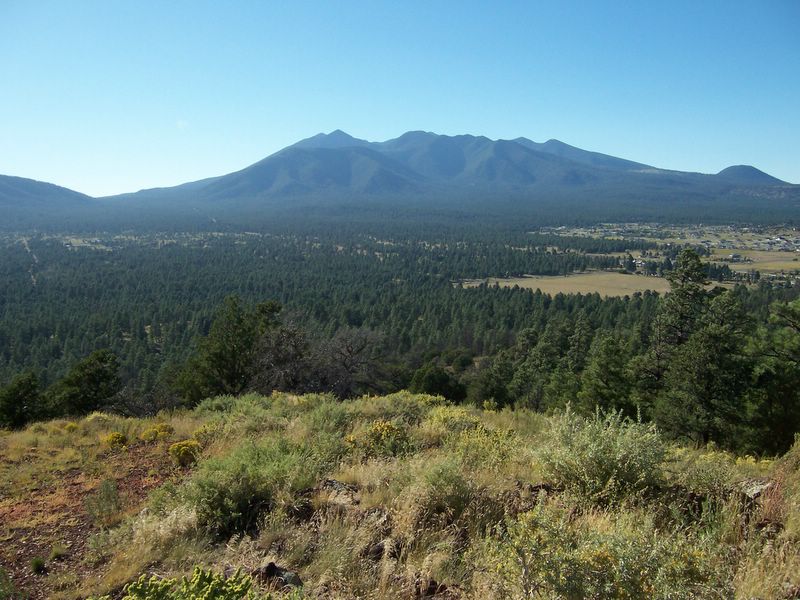
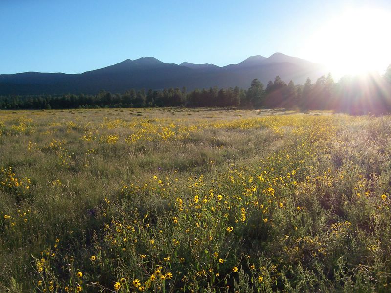
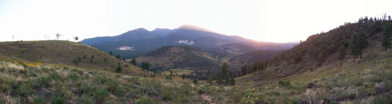
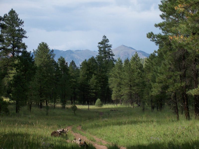
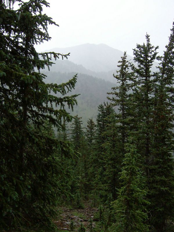
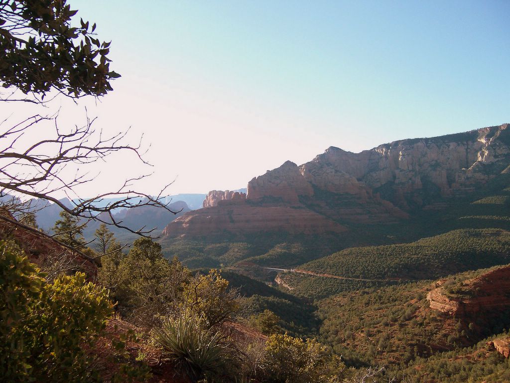
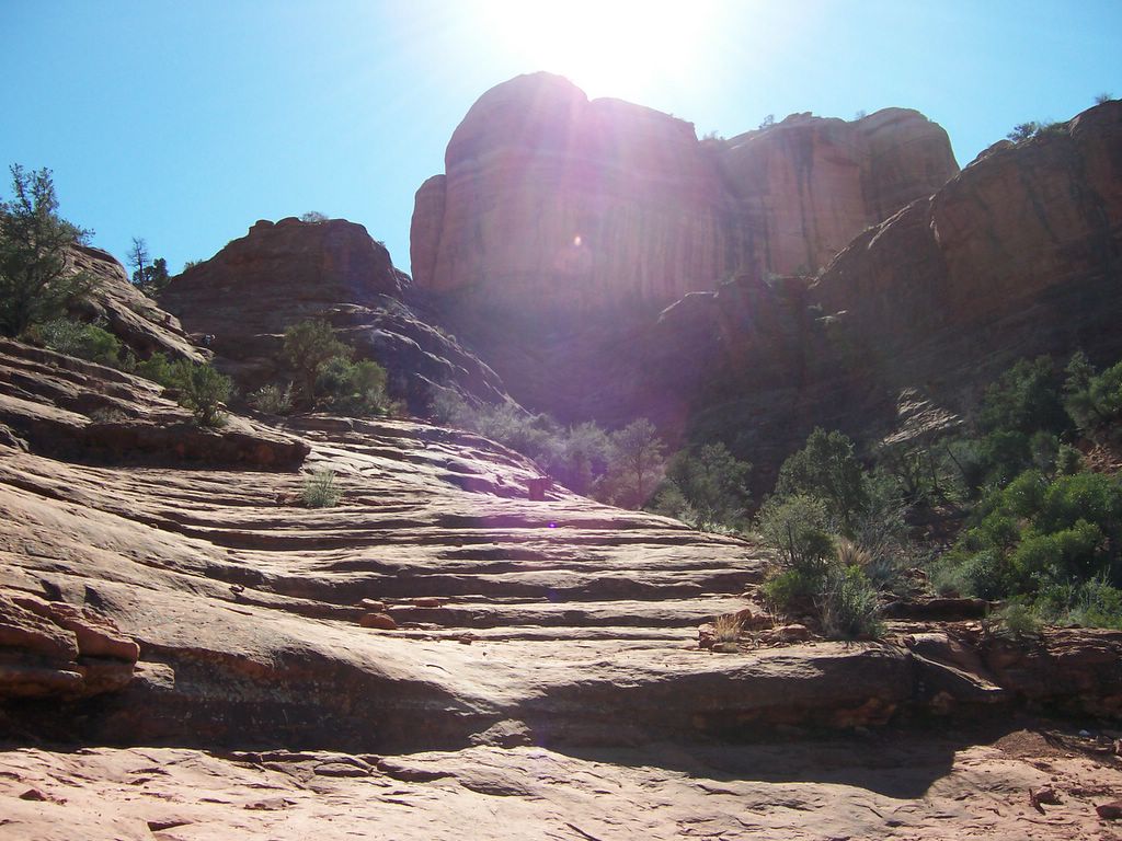
The day promised to be beautiful, and the weatherman mentioned rain that night... by the time we got on the road and to the trailhead, it looked like the rain would be early. It did drizzle a little, and was overcast for much of our hike, but when we got to First Bench, it was clear that we were at the edge of a storm to the north of us. Sedona was bathed in sunlight, and the rain even cleared enough to let us see the San Francisco Peaks.

The trail sign says the trail is easy, with an elevation change of a mere 1700 feet over two miles. Actually, the trail's not easy -- 1350 feet of that elevation change is in a half a mile (not that gaining 850 feet per mile is a relaxing stroll), with tall "steps" up rocks, and slippery footing in places (when it's dry, the gravel on the trail can be a bit tricky to come down). Thankfully, the Wilson Mountain Trail web page is a bit more realistic.

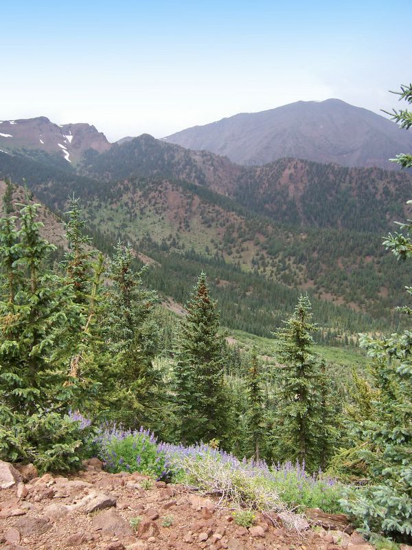
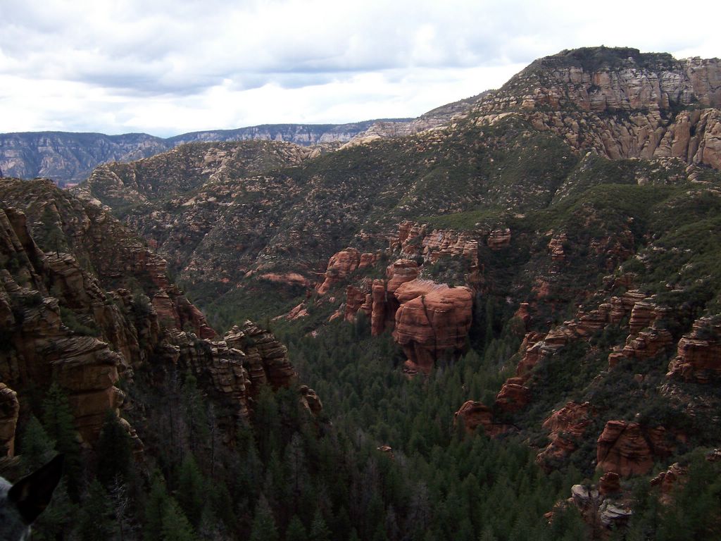
To repay you for the workout, you will be rewarded with a very pretty trail and fantastic views. The trail winds up a forested canyon, getting steeper as it goes. The views north up Oak Creek Canyon are excellent from this section of the trail. The trail pops out on First Bench of Wilson Mountain (1400 feet above the trailhead), where a mild grade takes you to the junction of North Wilson Mountain Trail and Wilson Mountain Trail. The latter trail coninues to the top of Wilson Mountain (2200 feet above the trailhead, at 7000 feet), which we have planned for the next blue-sky weekend. Keep heading south to get the reward -- breathtaking views over Sedona. On a clear day, the San Francisco Peaks are visible to the north. From First Bench, you can see straight into Munds Canyon, east across Oak Creek Canyon.

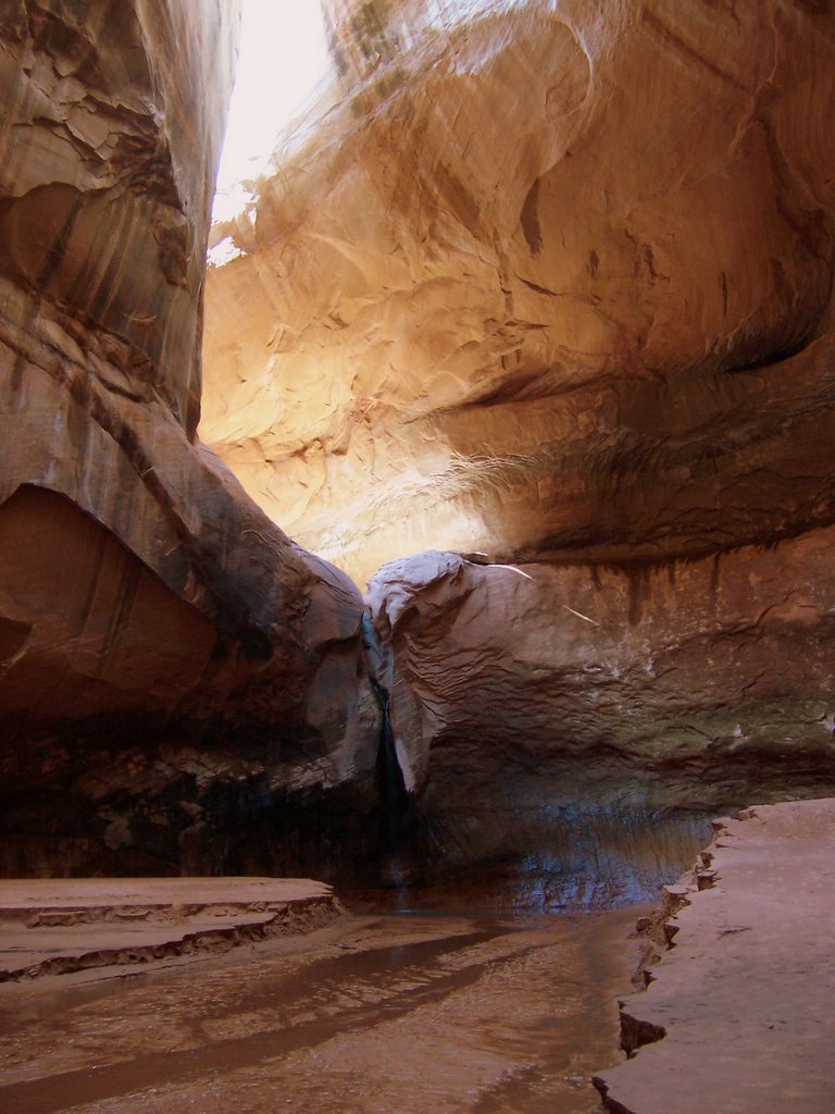
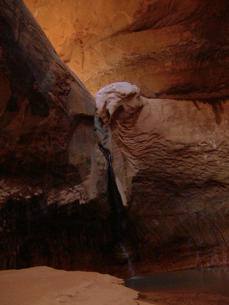
A photo is posted below. Visit my Earth Gallery to see all the photos from this hike.

Sunday, March 13, 2005


Red Rocks, Big Sky
View from First Bench, Wilson Mountain Trail, into Sedona
photo © 2005 deborah
www.deborah.ws

Saturday, March 12, 2005


Ring
See my Flame Gallery for more flame fractal wallpapers
photo © 2005 deborah
www.deborah.ws

Thursday, March 10, 2005

Cathedral Rock Trail

This is an excellent trail off of Back O' Beyond Road, about three miles past the 'Y' on 179 going out of Sedona. The trail up to the junction with Templeton Trail is pretty easy, and the views are great. From there, the trail's a bit more challenging, requiring a bit of scrambling up slickrock in a few spots. The trail leads up to a saddle in Cathedral Rock, where the views in both directions are spectacular. There's lots of nooks and crannies to explore, and we found a fantastic spot to eat lunch and enjoy the views. The trail is about 3/4's of a mile long and can be moderately strenuous in places.

Two photos from this hike have been posted below. Visit my Earth Gallery to see all the photos from this hike.


Cathedral Rock
Sedona, Arizona
photo © 2005 deborah
www.deborah.ws